


Oxfordshire map
Oxfordshire map
Couldn't load pickup availability
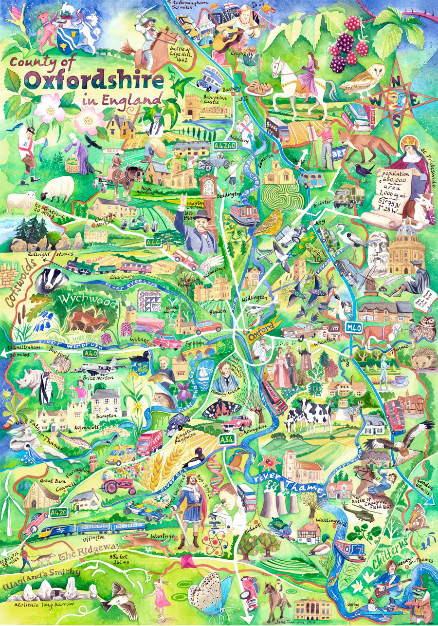
This hand painted Oxfordshire map shows the geography, history, nature, industry and much more!
My Oxfordshire map features historical characters, industries past and present, nature and geography, significant events, famous and vernacular buildings, as well as the rivers, railways and main roads. Clearly it’s not to scale. It's full of whimsy!
This painting was commended by the British Cartographic Society in 2015.
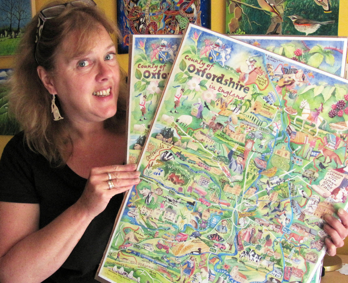
The original painting in watercolour has already found a home but right here you can buy
- an A2 size signed print
- a digital file for you to make a single print at a format and size of your choice.
This painting is also available as a jigsaw puzzle, tea towel, and greetings card.
The painting is my interpretation of the county featuring things that I consider important.
Industry
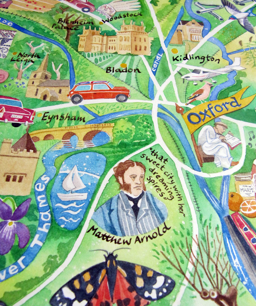
The car industry for example. Every car pictured on the map was built in the county, from the modern BMW Mini through to the Morris Oxfords and Abingdon’s gorgeous MGs. And racing cars too!
Oxfordshire’s important scientific heritage and world-leading technology industries are shown – from a strand of DNA to aeronautical engineering. I've shown older crafts and industries: quarrying, brewing, boat building, blanket-making, jam making and book binding.
History and people
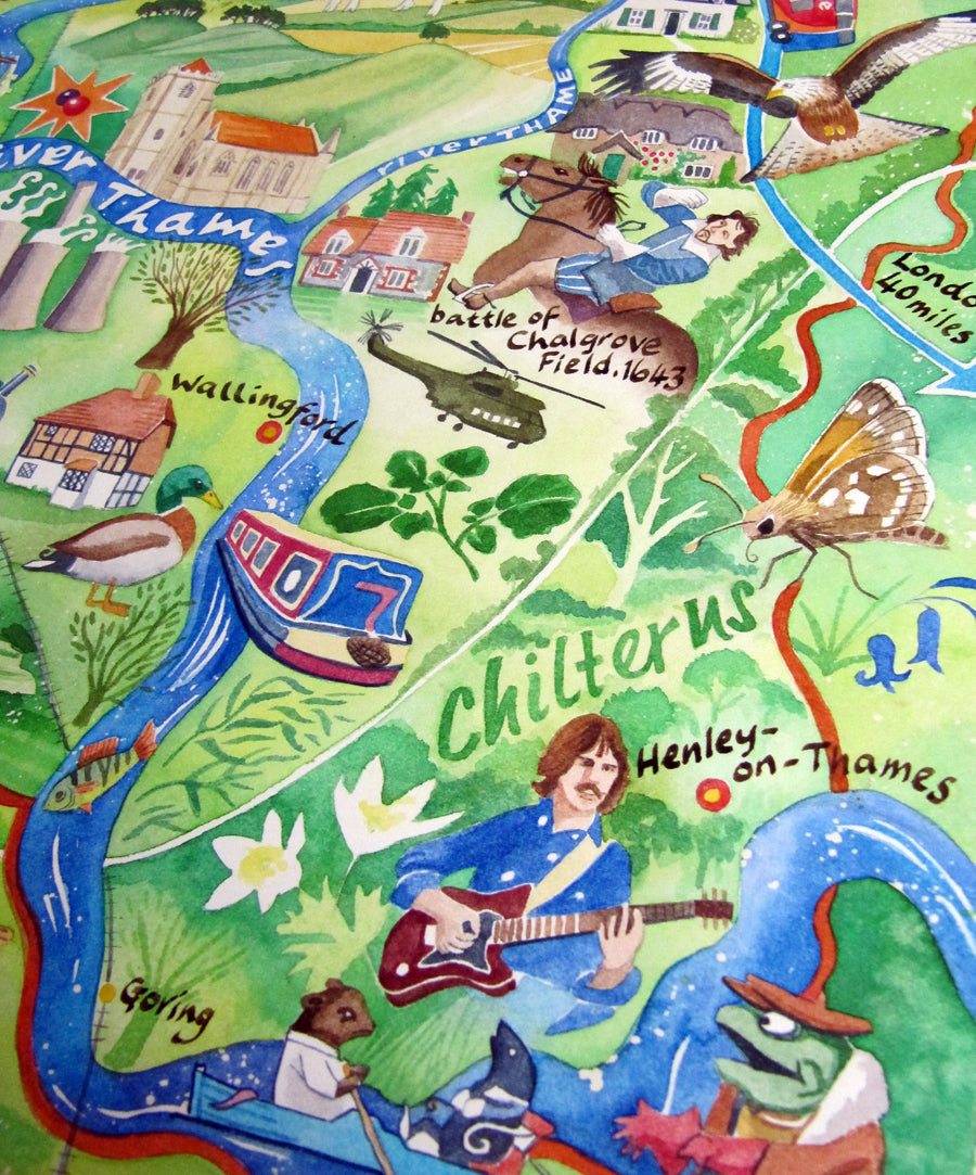
What a cast of nationally important characters hail from Oxfordshire! I couldn’t include everyone, but from politics I chose John Hampden from the Civil War, who rears up fighting at the battle of Chalgrove field. And Winston Churchill, of course.
The county has produced a number of kings. The star of the show is Alfred the Great, Anglo-Saxon king of Wessex. He was a learned and merciful man who understood the value of education and the rule of law. And I couldn’t help sneaking in just over the border with Warwickshire, a Parliamentarian riding into the battle at Edge Hill.
My map of Oxfordshire painting also includes the ordinary folk just going about their business – dancing, fishing, walking, riding – through our extraordinarily ordinary (but no less beautiful for that) rolling landscapes of watermeadows, farmland, woods and gentle river valleys, all of which support a precious variety of species.
County flower
Did you know that the snake’s head fritillary (Fritillaria meleagris) is the county’s official flower?
Music
Music is very important to me and so it features strongly on my map.
- Beatle George Harrison lived near Henley for many years
- Opera at Garsington
- Cropredy folk festival
- Mike Oldfield recorded his 1973 album Tubular Bells just north of Kidlington
Prehistory
Some of the very first elements I painted onto the map were Oxfordshire’s prehistoric features. The county is especially rich in ancient monuments.
The Ridgeway snakes its chalky way across the bottom of the map. And the spectacular Bronze Age White Horse is the highest point in the county at 856 feet. Less well-known are the Rollright stones, the Neolithic long barrow of Wayland’s Smithy, and the Iron Age hillfort of Blewburton. But now you know about them, so be sure to visit!
Oxfordshire has got the lot!
Shipping and delivery
Shipping and delivery
This website only takes orders from UK, Canada, Australia and New Zealand.
If you are not in these countries and you would like to make a purchase, please get in touch with me directly.
US customers: Since tariffs were introduced, I can no longer ship PHYSICAL items to the US, due to the complexity and expense. However, I can email digital images to you for self-printing. If you'd like to do this, please contact me directly.
EU customers: Since Brexit, I can no longer ship PHYSICAL items to Europe, due to the complexity and expense. However, I can email digital images to you for self-printing. If you'd like to do this, please contact me directly.
Posting your order
Typically, orders for physical products placed after 12pm on Friday, and on Saturday or Sunday will not be posted until Monday at the earliest. I use Royal Mail to dispatch your order.
If you have ordered multiple items, I will try to post everything together. Occasionally, this is not possible, in which case they will be dispatched in separate packages.
Digital files will typically be transferred to customers within 24 hours via email using WeTransfer, the file transfer website.
Buying an original painting? Please choose the tracked option!
UNITED KINGDOM (incl. Channel Islands, Isle of Man)
- UK Royal Mail second class – 3 to 5 working days (can be longer at busy times of year)
- UK Royal Mail tracked next day special delivery – next day by 1pm
If you choose a tracked delivery, I will be notified with your Royal Mail tracking number when your parcel has been dispatched.
INTERNATIONAL ORDERS
IMPORTANT! All international orders are shipped duties unpaid. Orders shipped outside of the UK may be subject to customs, taxes and duties. This cost is the responsibility of the customer and is payable on receipt of goods. Please check your local customs tax and duty costs as duties must be paid before the goods are released.
CANADA
Royal Mail International Tracked service (7-14 days)
AUSTRALIA and NEW ZEALAND
Royal Mail International Tracked service (7-14 days)


-
My art is for everyone
By selling my work directly to you, rather than through galleries or agents, we both get a better deal.
-
FREE P&P to UK addresses
My prices include second class postage and packing to UK addresses.