


Weather Map - folklore and fact
Weather Map - folklore and fact
Couldn't load pickup availability
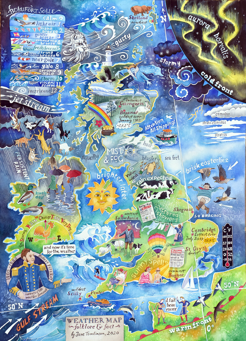
Weather Map of folklore and fact - a painting of the weather of the British Isles
This original weather map painting in watercolour has already found a home but you can get:
- an A2 size signed print
- a digital file for you to make a single print at a format and size of your choice.
This painting is also available as a greetings card.
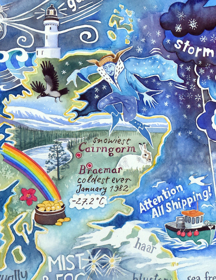
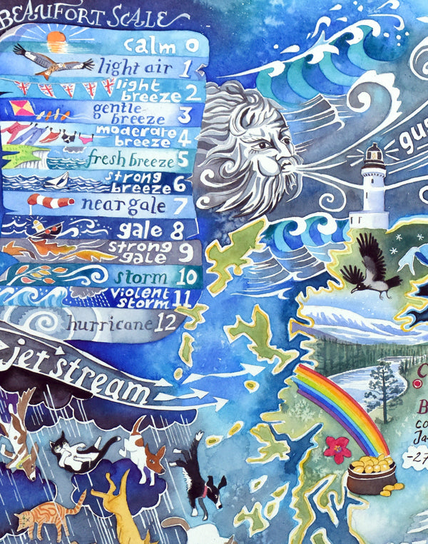
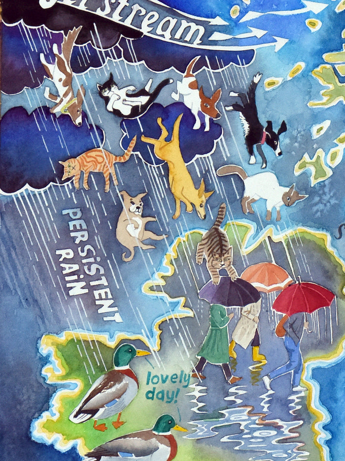
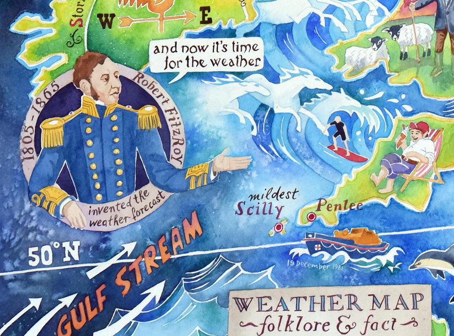
I'm British, so I am obsessed with all things meteorological. On my weather map I have stated facts, for example the hottest, coldest, windiest and wettest places. I've also illustrated weather folklore and it turns out there's a lot of that!
The British weather is influenced primarily by two major factors. The Gulf Stream and the Jet Stream. Between them, they bring the variation and changability of the British climate. We get it all - rain, sun, wind, snow, and sometimes a lot of it in quick succession.
Read more about my Weather Map in this blog.
Shipping and delivery
Shipping and delivery
This website only takes orders from UK, Canada, Australia and New Zealand.
If you are not in these countries and you would like to make a purchase, please get in touch with me directly.
US customers: Since tariffs were introduced, I can no longer ship PHYSICAL items to the US, due to the complexity and expense. However, I can email digital images to you for self-printing. If you'd like to do this, please contact me directly.
EU customers: Since Brexit, I can no longer ship PHYSICAL items to Europe, due to the complexity and expense. However, I can email digital images to you for self-printing. If you'd like to do this, please contact me directly.
Posting your order
Typically, orders for physical products placed after 12pm on Friday, and on Saturday or Sunday will not be posted until Monday at the earliest. I use Royal Mail to dispatch your order.
If you have ordered multiple items, I will try to post everything together. Occasionally, this is not possible, in which case they will be dispatched in separate packages.
Digital files will typically be transferred to customers within 24 hours via email using WeTransfer, the file transfer website.
Buying an original painting? Please choose the tracked option!
UNITED KINGDOM (incl. Channel Islands, Isle of Man)
- UK Royal Mail second class – 3 to 5 working days (can be longer at busy times of year)
- UK Royal Mail tracked next day special delivery – next day by 1pm
If you choose a tracked delivery, I will be notified with your Royal Mail tracking number when your parcel has been dispatched.
INTERNATIONAL ORDERS
IMPORTANT! All international orders are shipped duties unpaid. Orders shipped outside of the UK may be subject to customs, taxes and duties. This cost is the responsibility of the customer and is payable on receipt of goods. Please check your local customs tax and duty costs as duties must be paid before the goods are released.
CANADA
Royal Mail International Tracked service (7-14 days)
AUSTRALIA and NEW ZEALAND
Royal Mail International Tracked service (7-14 days)


-
My art is for everyone
By selling my work directly to you, rather than through galleries or agents, we both get a better deal.
-
FREE P&P to UK addresses
My prices include second class postage and packing to UK addresses.